Why and by which route.
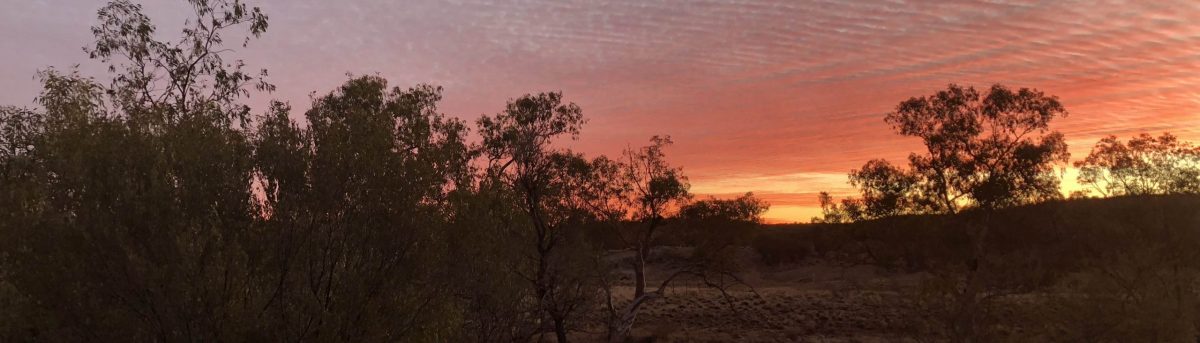
And now for something completely different – an outback bicycle trip.
The time was some time mid year in 1993 and well, it seemed like a good idea at the time. We planned to leave in June 1994 so as to avoid the heat. So, there was a lot of planning to be done and limited time to do it.
To set the scene a bit. I was a member of the Melbourne Bicycle Touring Club which met every Thursday night for trip planning, socialising, club auctions, etc. After the meetings quite a few of us usually adjourned to a local pub for a few drinks, possibly a meal and more socialising.
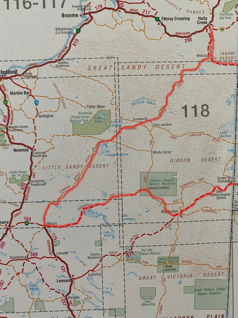
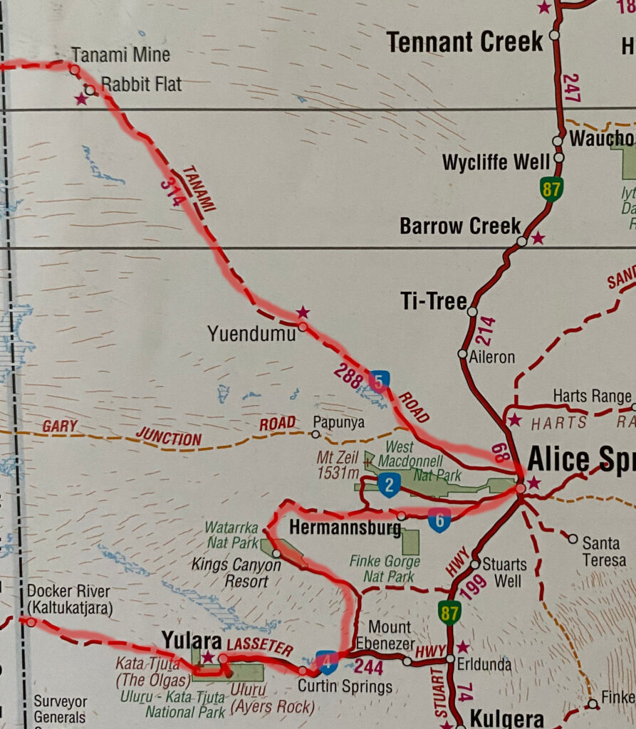
It was during one of these after meeting sessions that someone who was old enough to know better (NOT me) suggested a bit of an outback trip. I hasten to add that before the suggestion much Guinness, possibly too much, had been consumed. And so, a plan was hatched. A completely harebrained plan at that. The plan called for whoever was going to get the train from Melbourne to Alice Springs (NT) and from there to head westward to Wiluna (WA) via the Gunbarrel Highway / Great Central Road, north to Halls Creek (WA) via the Canning Stock Route and south east back to Alice Springs via the Tanami Road and then home by train to Melbourne.
Then some bright spark suggested that as the expense of a support vehicle would be unaffordable we should do it unsupported. As I say, harebrained.
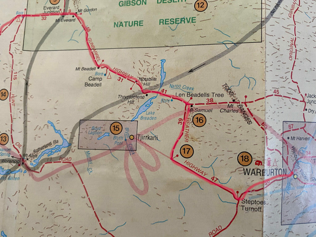
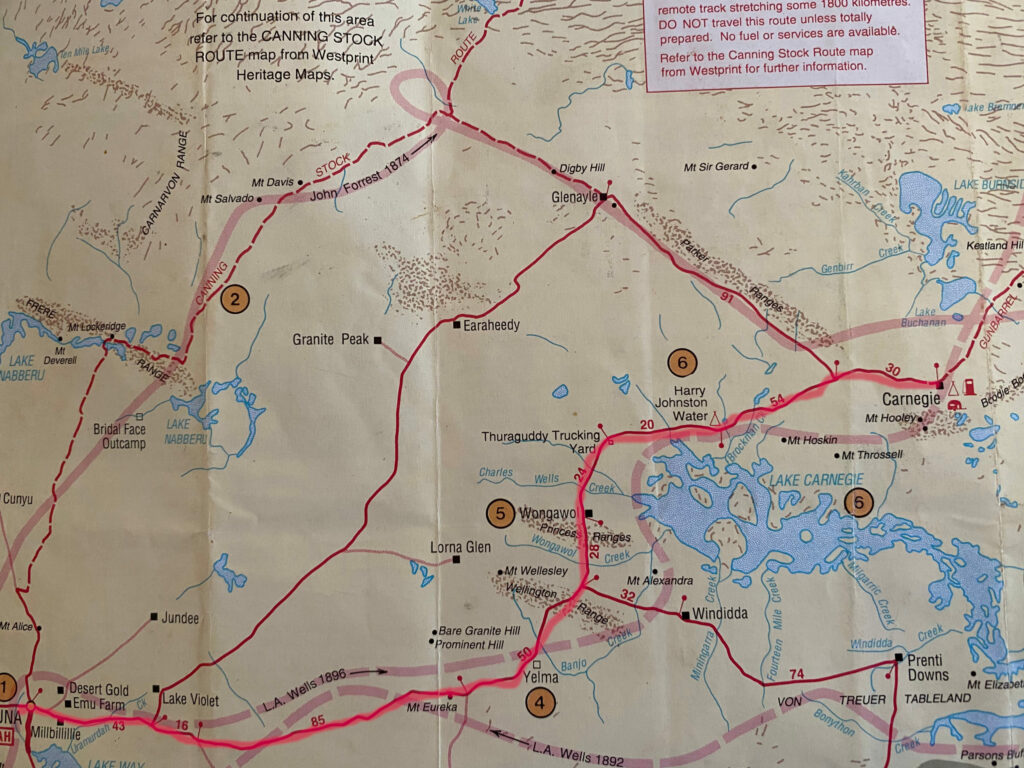
Here’s a picture of a map with the proposed route in red. This is just the Western Australia part of the route.
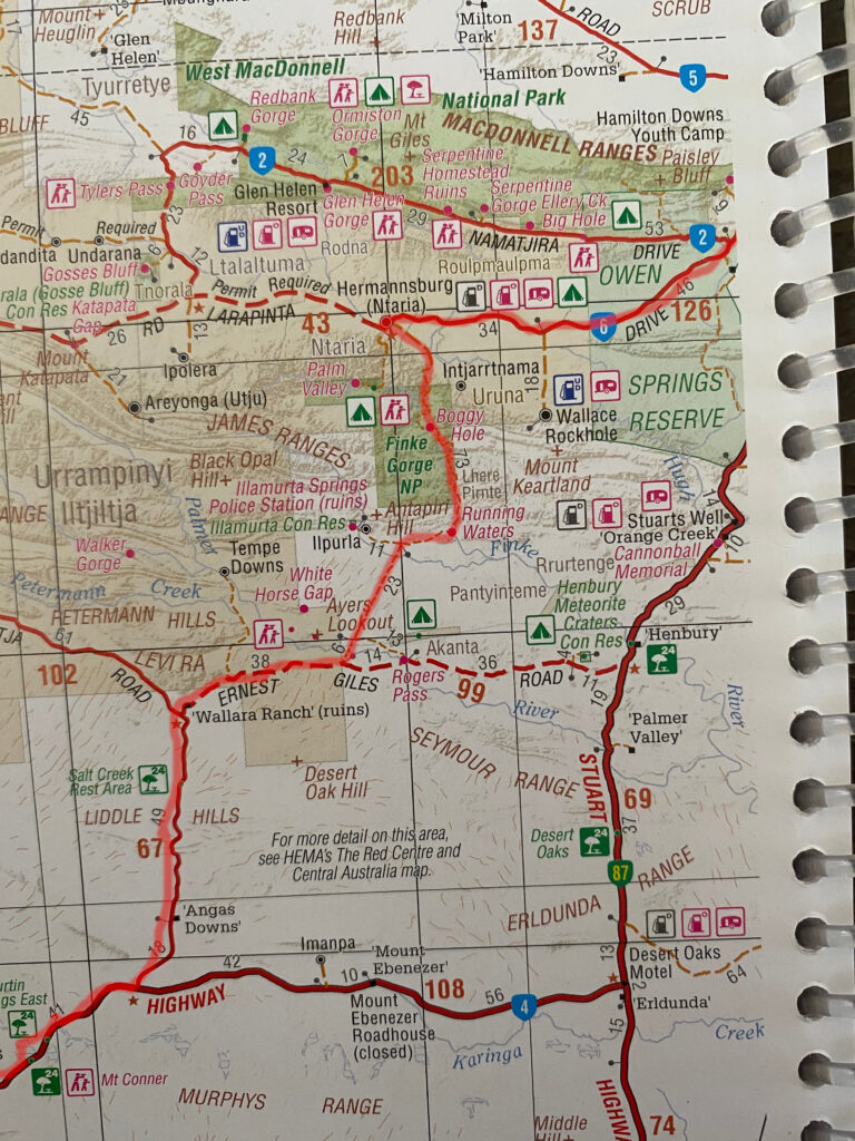
And here’s the NT part of the route.
Food
We started with food. Steve came up with a spreadsheet and a huge-arsed thing it was too. It was obvious from the start that we would need to plan for food drops. The first was at Giles Weatherstation with the next being at Warburton. From Steve’s spreadsheet we could work out how many meals we’d need and the time and distance between depots.
So, what do we eat ? One thing that was plain is that there was no way we were going to be eating fresh food – it needed to be dehydrated. Steve and I both had Harvest Maid food dehydrators so we got to work drying fruit and veg. Lots of fruit and veg. From experience I can tell you that dehydrating tomato’s is something to be done in a well ventilated outdoor area. It stinks. Badly. At around this time a new startup was looking for consumers for their Adventure Food range. Our timing was perfect. They were looking for testers and we needed a lot of dehydrated food at a low cost. They asked us to test their range and report on it and in return they supplied us with what we needed at no cost. Perfect.
So that was food sorted. We’d eat a combination of Adventure Food meals and our own dehydrated stuff. Onto snacky stuff and energy drinks.
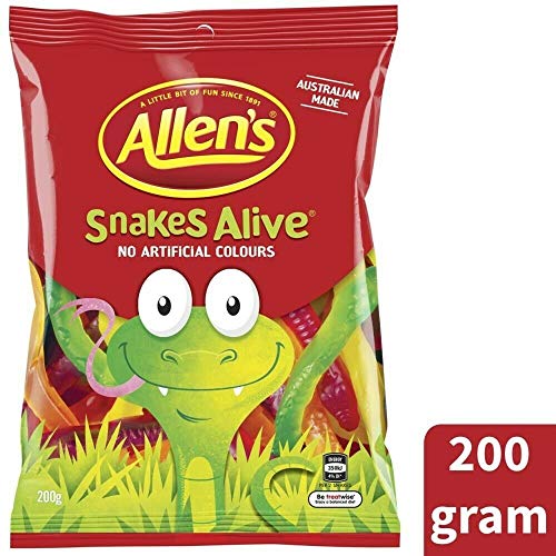
For snacks we took a lot of dates and Allens Snakes
For energy drink we took a powder called ISOSport which only needed to be mixed with water. Pity it is no longer made.
Once we had worked out what we were going to eat and got it all together we had to work out where we wanted it.
We needed to work out out how many days worth of food and water we could carry and we also needed to work out where our food depots were going to be. We settled on Giles and Warburton for the Gunbarrel Hwy / Great Central Road part of the trip – I’ll only cover the first leg of the trip here from Alice Springs to Wiluna. The rest followed a similar pattern. We found after considerable “map staring” and many phone calls our longest stretch without being able to be resupplied with anything was going to be about six or seven days.
At this point we had a huge great pile of food on the lounge room floor so we set out dividing it up into piles to be sent to the depots. Once that was done it needed to be packed into containers and dispatched. Freight was going to be an expensive exercise. The freight companies wanted to charge us an absolute fortune to get our food to the required remote location. Then, on a whim I called Australia Post seeing as they deliver mail to these places. Their rates were about a quarter or less than those of the freight companies. Guess who got our business. AusPost delivered on their promises too.
Right that was the food sorted and sent.
The actual ride. Alice Springs to Curtain Springs.
We got to Alice springs and went to a caravan park to get organised. We worked out how everything was going to be packed and filled up our water bags. We needed to get some stove fuel – metholated spirits and shellite (white gas) as we couldn’t take that on the train. We did a little bit of “discretionary” shopping while we were at it.
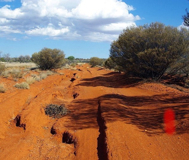
After that we retired early for an early start the next day. Off we went along Larapinta Drive towards Hermannsburg which is a distance of about 130km. We camped along the road a bit more than half way. That first night we discovered how many three corner jacks, usually known as “bindies”, there are in Central Australia. The things are everywhere.
It doesn’t matter how they land they always have one “spine” pointing up ready to puncture tyres, air mattresses, feet, anything. It transpired that Slime in the tyres was a good thing as the next morning showed a number of little green spots on our tyres which was hardened Slime doing its job and sealing the holes.
Next morning we packed up and headed to Hermannsbug where we poked around for a couple of hours and then it was off to our turnoff which would take us through the Finke Gorge and towards the Lassiter Highway to Uluru.
It was along the stretch through the Finke Gorge that we saw perhaps the strangest thing of the whole trip. We were riding along a good clay road through open red dirt wood land when we happened across a gentleman standing by the side of the road eating an apple. We were in national park and there was no shelter or car in sight, just this man eating his apple. As we rode past, despite us calling out to say g’day all he said was “yeah” and turned around and walked away from the road. Strange indeed.
Anyway after a couple of bush camps and a rest day in the Finke Gorge we hit the Lassiter Highway, turned right and pretty soon found ourselves at Curtain Springs – another place of great strangeness epitomised by a wall decoration of a spear fitted with a telescopic sight.
We had a good meal after a bit of a palava regarding paying for the meal and then having to go back to the bar to get “meal tickets” for cookie. The meal tickets were shot glasses of rum. After the meal, which was damn good and HUGE, we had a couple of drinks and retired for the night.
Curtain Springs to Giles
Next morning we woke up, breakfasted, garnered ourselves a water top up and set sail for Uluru and Yulara (the resort). All bitumen and quite a fast ride.
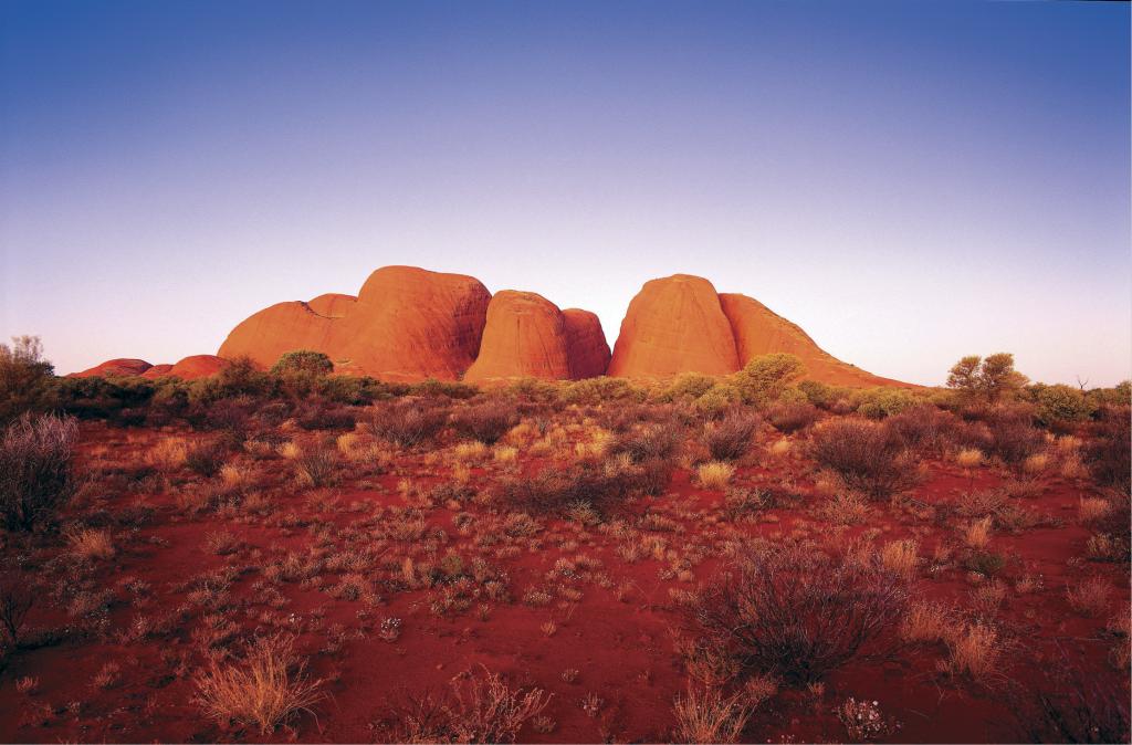
We spent a couple of nights at the resort camping area before heading off to Kata Tjuta / Mt. Olga where a great many photos were taken.
We would’ve like to stay there but our permits didn’t allow us to camp on the Aboriginal land that we were on so we had to carry on until we were off the land which made it a very late camp – we made camp at around 10.00pm.
We trundled on for a few more days until we reached the outskirts of the Docker River Community where we stocked up with water and a few other bits and pieces of food and were on our way in the direction of Giles where a food depot was waiting for us.
On our arrival we got ourselves situated and wandered across the road to the weather station to collect our stuff and to introduce ourselves to the staff there. We had all our stuff in the cabin and started on getting it all sorted out. For the rest of the afternoon we did the mandatory shopping – stove fuel, snacks, filled up our water containers, etc. During the afternoon Nat made a pineapple upside down cake for the staff at the weather station so after dinner we wandered across to give them the cake. And help them eat it of course. As we were on Aboriginal lands there was no alcohol allowed so a drink was not an option. Still, cake and coffee was pretty damn good.
We arrived at Giles just in time for an Indigenous player football carnival. The players had come from as far afield as North Queensland and northern Western Australia and the rest of the country. Some of the more distant players and their families had driven for three or more days to get there. We watched a match and there were some very, very good young players on display. This carnival is of some importance to the Australian Football League too and they had sent some player “spotters” to see if there was any young talent worth talking too. In my view they were going to do a lot of talking and soon.
The next day, after our tour around the weather station, we went off on a guided tour of a few places that are significant to the local indigenous people. Very interesting and educational it was too.
That evening after we had our meal we got our bikes packed so we could head off early-ish in the morning.
There are no photos from since we left Hermannsburg as the local indigenous people and the permit forbid publishing pictures of the land and people. Suffice to say that between us we have hundreds of slides that we can’t show or publish.
Onwards towards Camp Beadell
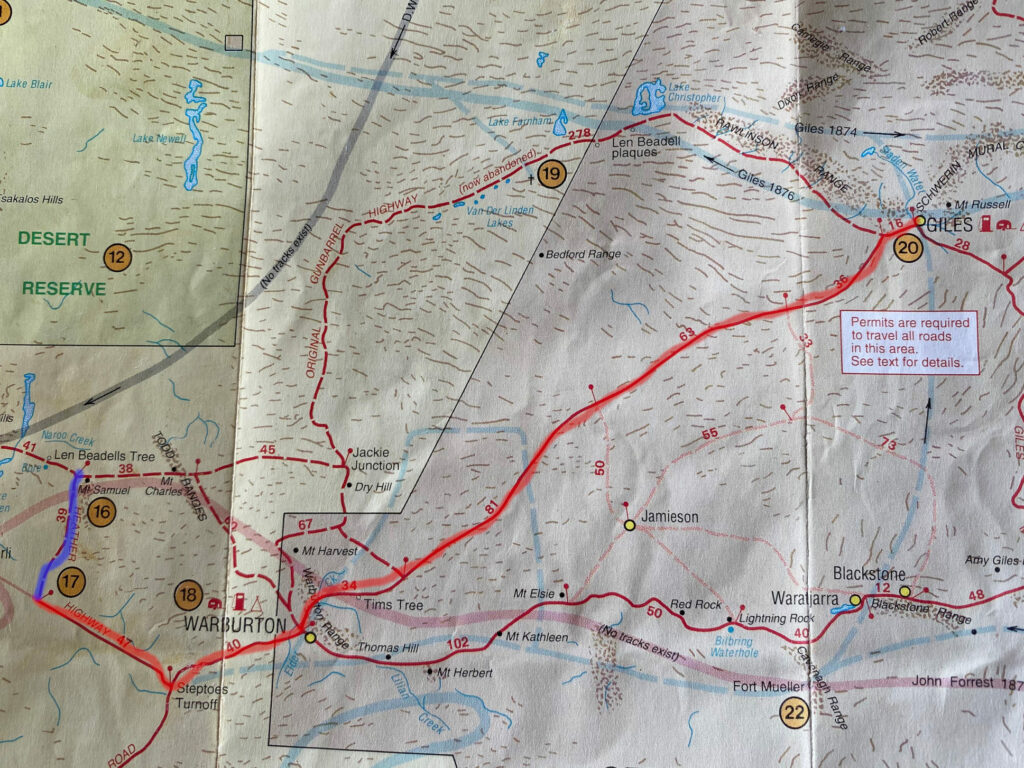
Although we had traveled across some truly awful roads this next bit had some real shocker sections with the worst road on the planet being the Heather Highway. On this map the good road is highlighted in red with the worst bit highlighted in blueish-purple.
After a few days of pedaling and a number of bush camps we arrived at Warburton. The usual happened – a bit of shopping and got our water topped up. We headed west to Steptoes Turnoff and turned onto the Heather Highway towards Len Beadells Tree and Mt. Samual. All I can say is that Heather must have been a very nasty piece of work to have that road named after her. It was dreadful. Rutted, corrugated and altogether nasty.
This bit of road was thankfully quite short. Normally were were doing about sixty to eighty or more kilometres per day. The Heather Highway was 39 kilometres in length and it was a very long day – about nine hours of sheer hard work.
After we got off the Highway of horror we headed west for about 70 kilometres to Camp Beadell where we spent a couple of days resting. Natalie even made us an apple crumble with stuff she had in her panniers and very delicious it was too. We had a bit of a cleanup at the bore at Len Beadells Tree but the water was quite unsuitable for drinking. It almost had enough mineral content to be smelted. The bore at Camp Beadell was dry so no water there.
It’s worth noting that on this stretch from Warburton to Carnegie Station we were carrying enough food and water to last us eight days. Our bikes were very, very heavy.
Off to Carnegie Station
After our little rest at Camp Beadell we were off to Carnegie station but first Everard Junction.
After leaving Camp Beadell we decided to have a stop at Mt. Beadell for a look at the view. As we were riding up the small and very rocky hill Nat had a puncture. I was riding close behind her and when she sliced her rear tyre on a bit of rock all I could see was a green cloud coming at me. It was, if course, the Slime escaping from her tyre. A quick tube and tyre change and we were on our way. About a hundred metres further on I managed to have the only spoke breakage for the whole trip so that was another quick repair job.
The view from Mt. Beadell was as good as you could hope for. It was unobstructed 360 degrees out across the desert in all directions. Sadly I don’t have any photos as my camera had long since been shaken into inoperation.
On we went to Everard Junction where we found two curious things. A bus shelter (yes, a bus shelter in the middle of absolutely nowhere) and a 44 gallon drum full of cans. Each can had in it a note from the people who put it there. We put our names and a short description of the trip on a piece of paper and put the note in an IsoSport can and placed it in the drum with the rest. On we went.
A couple of days after Everard Junction we had a little bit of rain. This effectively turned the road into glue. The stuff stuck to everything it came into contact with – especially tyres. After a few metres the tyres were jammed solid and unable to turn so the only option was to hack most of the mud out with a bit of stick and carry on for another twenty or so metres. This carry-on got really tired really quick so we pulled off the road and made camp at the bore about 32 kilometres west of Everard.
Next day dawned bright and clear and the road had dried out enough for us to make some real progress towards Carnegie Station.
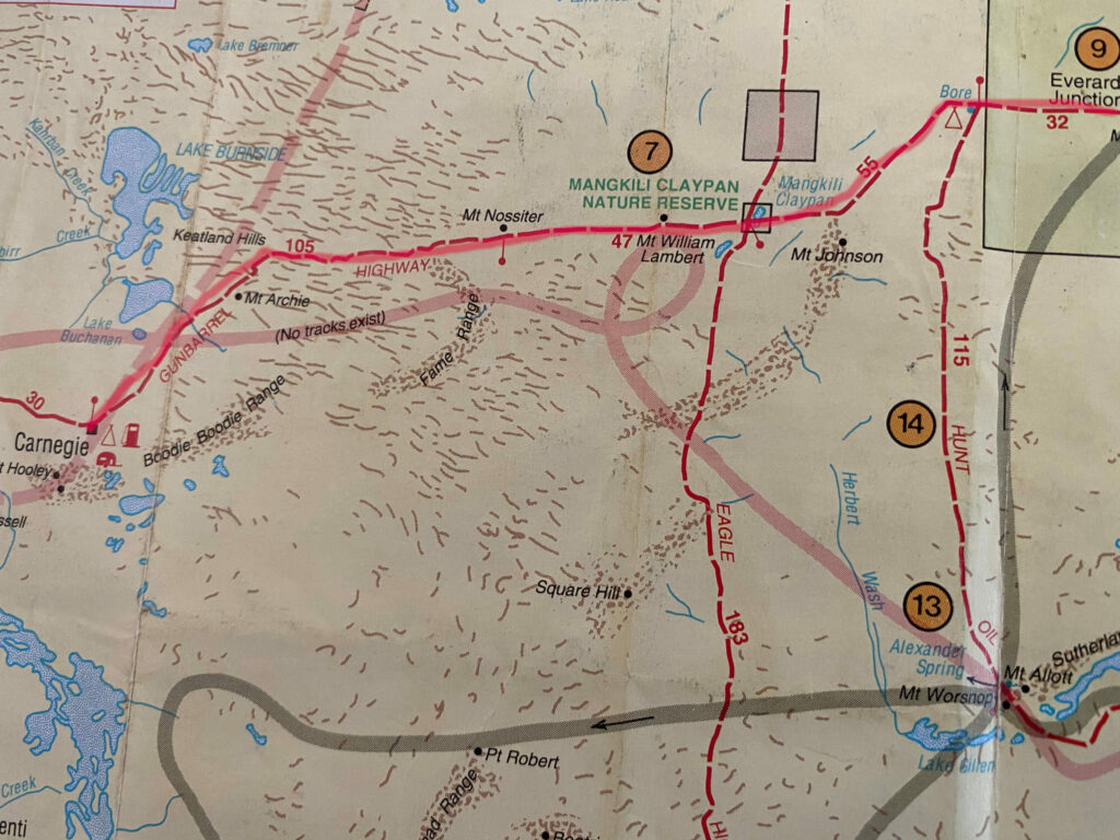
After a few days of largely uneventful travel we arrived at Carnegie Station. We could easily tell when we crossed the station bounday – the fly population increased to epic proportions.
First thing on the agenda after we got our camp set up was a shower. We needed to wash the red dirt and sweat we had collected since Warburton off. Lots of sweat and lots of red dirt.
We only stayed there for one night but as we had arrived early in the afternoon we had plenty of time to stock up on some high, low GI carbs and, of course, fill up our water bags. We were getting a bit low on water by this stage.
And on to Wiluna
This was to be the last leg of the trip for me. I had decided that I had had enough and would head to Kalgoorlie and from there get the train back to Melbourne. More of that later.
This was another long stretch with no prospect of a resupply. Very heavy bikes again.
The cycling was pretty easy in the scheme of things. Both Al and I managed to fall off pretty heavily and painfully but no damage apart from a couple of corked thighs.
At Wongawol Waters we happened on the most perfect camp site. There was an abundance of cool clear water that was very drinkable so we stayed a couple of days and of course, topped up our water bags.
So, Westward Ho and all that.
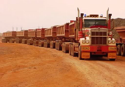
By now we were starting to see mining traffic on the road which had magically transformed into wide, billiard table smooth hardpack. Bliss. Mining road trains were starting to become an issue but as we were on bicycles we could hear them coming from miles away. They are big and long – up to eight trailers of ore. And boy do they kick up some dust. Lots and lots of dust. Really thick walls of the stuff.
And so to Wiluna. We went to the post office and collected our Post Restant mail and headed off to the caravan park and got set up. Nat’s friends had driven up from Kalgoorlie to meet us so we sat around and had a well earned drink or two before heading off to the pub for dinner where Al managed to collect a dose of mild food poisoning.
The whole mood of the town was terrible. It’s a dreadfully racist place. The caravan park had a big high fence surrounding it and the gate was locked at 10.00pm. The pub was segregated and was also surrounded by a big high fence. The place seemed to be full of uncouth, racist men who looked down on everyone who wasn’t in the “mining game”. The local indigenous people were generally looked down upon and were treated as some sort of low cast person. The four of us found that attitude to be disgusting and absolutely unacceptable.
A thoroughly unpleasant place.
Thank you Mark! I really enjoyed reading your narrative. I learned a lot about Australia such as Three Cornered Jacks, Sorry Business, Coopers Sparkling Ale and the Heather Highway. This was an educational and fun excursion!
Thanks for the kind words John.
We’re currently waiting for the COVID dust to clear and then there’ll be a big trip happening.