The big trip change of plan

Our hand has been forced

Well seeing as COVID-19 has wrecked our plan and seeing as the cars gearbox still isn’t done we’ve decided to wait a while and aim for the Birdsville Races in 2021. Hopefully by then all the COVID-19 messing around will be minimised to the extent that we’ll be able to travel. By then the rebuilt gearbox will have had a few trips to prove itself too.

The first thing to do is to plot a map and make an approximate fuel use and cost spreadsheet. The map is from Google Maps as are the distances and driving times. The spreadsheet is just something that I do for every trip to try and predict distances, fuel use, driving time and so on.

The first draft of the new route

A bit more detail

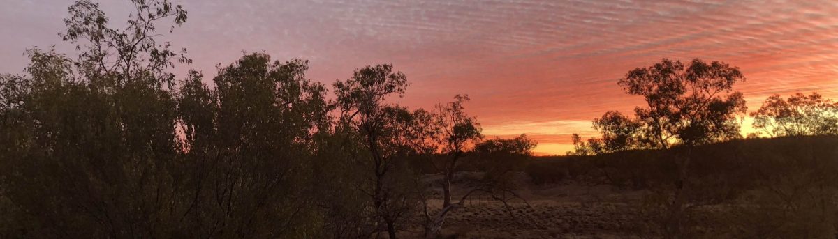
As you can see we have added more to the trip so we can take in the Birdsville Races. We went to the races in 2017 and had a great time, apart from a few flat tyres, so seeing as 2017 was a great trip we’ve decided to incorporate the races into our big trip.

Last time we went up to Birdsville via Western NSW – Tibooburra, Cameron Corner, Innamincka, etc. but this time we’ll go to Birdsville via Bourke, Quilpie, Windorah and on to Birdsville.

After the races we’ll head on over to Alice Springs via Bedourie and Boulia and after a restock we’ll head on up to Darwin and Kakadu.

After a bit of a poke around we’ll head over to Broome and down via Geraldton to Perth. From there we’ll go down to Albany and then across the Nullarbor to Moe via Adelaide.

In total Google maps tells me it’ll be a bit over 13,000 km’s. Of course it’ll be further than that because I haven’t mapped the side trips – Kakadu, west coast, south coast, etc.

And so to a spreadsheet.

As mentioned in other posts, and earlier in this one, I like to make a bit of a spreadsheet for each trip. I’ve put two versions of the first draft for this trip up – OpenOffice and   MS Excel. Feel free to download them and use them if you wish.

It’s a pretty simple spreadsheet and is subject to change as we go along. It comes along with us on a laptop so we can change it, add to it, add notes, etc. Call it a rough outline of the trip and as with the map it’ll change. We’ll being doing detours, side trips, unscheduled stops, etc. along the way – especially Kakadu, the west and south coasts, and other places.


So what’s happening with the big trip

At this juncture a big fat nothing

So here we are still stuck at home. The borders are all closed doe to COVID-19 so we can’t leave Victoria unless we either have a permit or are willing to quarantine ourselves in a state government mandated facility which could be rather expensive. That’s not an option for us so we’re stuck at home.

There are only four reasons that we can go past our front gate – shopping for essentials, medical reasons, exercise or to work if working from home isn’t an option. That means that scooting off for a week or two into a National Park or a caravan park somewhere isn’t an option.

I short we’re stuck at home going stir crazy.

The camper is serviced and all we need to do is to fill it up with bedding, food, water and a couple of containers of fuel and go.

We’ve taken the opportunity to rebuild the gearbox of the car so it’s loafing around with its gearbox in bits on the floor. Getting a full rebuild kit is a problem as it needs to come from Germany and has thus far taken about three weeks and it still hasn’t left Germany. It only weighs a couple of kilograms and is about the size of a shoe box.

So what are we doing

Again, not very much.

We’re doing our best to look after our mental and physical health. We are both heartily sick and tired of this “lockdown ” caper and the indefinite postponement of the trip of a lifetime. However, we do what we can and look forward to the time when the end is in sight and we can get going. It does look like we’re in it for the long haul though.

We’ve been keeping up with all of the COVID-19 developments including listening to the daily press conferences by our various government leaders in the hope that restrictions will be eased a bit so that we can go somewhere – anywhere will do at this stage.

While the car is bits we can’t even drag the camper out of the garage to set it up in the driveway and pretend that we’re out camping.

As well as waiting to get the bits for the car I’ve been playing around with the back end of this web site and trying to get it to figure more in Google’s search results. Of course, that’d be helped if I had more content to post. I’m sure people don’t want to read endless posts saying that we’re still in lock down and that we aren’t going anywhere ant time soon.

I’ve been playing around with a few other bits and pieces on the Raspberry Pi as well as looking around for TV shows and movies to download although we’ve still got a number of unwatched movies to go through.

At least our football teams are going OK-ish in this truncated mini series of a footy season even if the games are all lacklustre affairs.

That’s it from me. Seeing as I’ve been slack and it’s lunch time I’m off to do the dishes and get a sandwich before we turn the TV on and watch The Chase.

So how do we get out of this mess

Well, we can wait until the dust settles and we can move to a less restricted situation. Or, we can hope that someone, somewhere, comes up with a workable vaccine so we can at least feel safe-ish.


Planning the route in more detail

Planning tools

When we’re planning where we want to go and the basic route to get there we tend to hit Google Maps as we find that it’s the easiest way to get a route overview. It’s a neat tool – you can zoom it in or out, you can see satellite views, street views and the attractions in a town that you may be passing through. You can copy the way points to your GPS or SatNav as long as it’s compatible.

The next tool on the list is WikiCamps This is a paid app for your planning. A neat feature is that you only need to make one purchase per operating system We have two licences – one for our desktop Windows PC’s and our Windows tablets and the other for our iPhones. It has a truckload of camps listed and all sorts of filters. Want free camps ? Just use the free camps filter. It also has reviews and photos for just about every site as well as indicative costings. There is a trip planner built in which I haven’t come to grips with yet. Allegedly it’s quite easy to use once you overcome the learning curve. You can also download a heap of offline maps and content so you don’t need to be able to be connected to the internet to use it.

The other tool that we use is Findacamp which is a free web site which requires internet access. In most cases a selected camp site will have the available facilities listed. It also lists a heap of info as well as directions for each camp site.

Of course we also use paper maps – the Easy Read Road and 4WD Atlas from Hema and WAC maps. No batteries or internet access required – they’re paper. If you’re using paper maps, a compass is a must have. The atlas is especially useful when Plan A goes to the dogs. Another very good and useful series of paper maps are the World Aeronautical Charts. They are 1:1,000,000 and I’ve used them heaps. In the mid 1990’s a group of us did an unsupported pushbike ride across the Gunbarrel Highway from Alice Springs to Wiluna (WA) and our maps of choice were the WAC maps. We always carry the Hema Atlas as well as the relevant WAC maps with us. Currently Geoscience Australia is collaborating with Airservices Australia to revise their WAC maps.

The last tool that we use is a GPS or SatNav or whatever you want to call. it. There are so many brands and models out there that it’s almost a joke. We use two. A VMS 700HDX and a TomTom if indeterminate age. When buying a GPS have a good read of the specs, especially the operating temperature. It’s going to be stuck to your windscreen in the full sun for a lot of its life and the last thing you want is for your GPS to suffer from heatstroke. Our VMS unit does suffer to an extent and of course it always decides to have a fainting spell just when we need it most. This is when good old fashioned paper maps come in handy.

That just about rounds out our planning and trip tools apart from one the comes with the car. The Odometer.

Planning

So here we are in early May 2020 in COVID-19 lockdown. We are both in the “at risk” category and we are told that if we can stay at home then do so. Essential local travel only means just that. People aren’t measuring their car fuel consumption in Litres / 100km’s, we’re measuring it in litres /week. Last time I got fuel was over a month ago.

So we’re stuck at home bored. What to do ? Well we’ve been idly talking about a big trip for  a while now and while we’re stuck at home we may as well get on with a bit of planning and preparation.

The car needs a gearbox valve block overhaul and a new fuel pump. I’ll have to do the throttle position sensor too. Then there’s the usual greasing and checking as well as an oil and filters change to be done.

The camper also needs a bit of maintenance – wheel bearings checked and repacked. Water tank cleaned and flushed, etc.

We need to set dates to take advantage of the weather and to avoid the worst of the Northern Australian wet season which is loosely November to April. We also need our travel dates to dovetail nicely with other activities that we’d like to fit in. Campground Hosting in South Australia and the Northern Territory for example.

Organising a house sitter and our finances are also pretty high on the list of priorities too.

Working out our finances is going to a bit of fun. We’re both on limited and fixed incomes a d so far I’ve only done a really rough calculation of fuel costs – about $3,000, probably more.

We are planning to be away for up to six months so there’s a fair bit of planning and preparation to get on with which should keep us occupied at least until we’re allowed to travel interstate again – the state borders are currently closed so we have to at least wait until they’re open again. So at this stage we have no idea when we’ll be leaving or when we’ll be back.

It seems like a whole bunch of “pie in the sky” stuff, doesn’t it ? Bear in mind though that every trip starts out like this. Also bear in mind that we don’t do contingency planning, we go with whatever is happening at the time. Have a read of Preparation and What to do when Plan A goes to the dogs .

When we’re planning a trip we plan the route and from there we can plan our fuel usage. More about the fuel use planning later. We also sort of plan where we’re going to stop each night – bush camp, caravan park, show grounds, etc. That tends to be a part of the fuel planning spreadsheet. We don’t bother with planning food or shopping as we find that we can always find somewhere to do a shop when we need to and we only ever find that we spend about the same on shopping as we do at home.

First up is a draft route but I can see a number of articles before we leave and then of course a much larger number of articles during the trip.

Anyway on with the route planning

Planning the route

The proposal is to basically follow the blue line on the map. We have probably decided to avoid the Gibb River Road at this stage. We may alter that decision as the planning goes on. This is the first draft of the route.


The route is about 12,000km’s and I’d expect it to take somewhere between twelve and twenty weeks depending on where we actually end up going and what we want to see and do. Campground Hosting in NT and SA are high on the agenda so that’ll add a few weeks as well.

Travelling about a thousand kilometres a week seems reasonable, at this stage anyway.

Once the route comes together a bit more we’ll be able to get a better handle on approximate fuel costs. Currently it looks like about $3,500 given that we’ll get around 13 or 15 Litres / 1ooKm’s and working on an average fuel cost of $1.50 or $1.70 / Litre.